Much as New York City’s High Line, using principles from ecological urbanism, transformed an old freight line into an urban greenway, the proposed conversion of the six-decades-disused trolley terminal on the Lower East Side into a park called Delancey Underground, will inevitably be known as the Low Line.
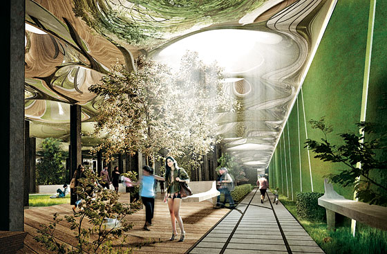

Delancey Underground Park: Plan Utilizes Subterranean Photosynthesis
Adapted From New York Magazine by Justin Davidson
Land for parks is so scarce in Manhattan that the city’s most generous new green space, the High Line, occupies an elevated railway. Now three urbanist entrepreneurs—James Ramsey, a satellite engineer turned architect; Dan Barasch, an executive at the social innovation network PopTech; and the pedigreed money manager R. Boykin Curry IV—hope to mine roughly two acres of green space under the city streets.
Much as Joshua David and Robert Hammond transformed an old freight line into an attractive strip of greenery, this trio wants to convert the vast and dank trolley terminal that has sat disused on the Lower East Side for six decades into a park that they are calling Delancey Underground but will inevitably be known as the Low Line.
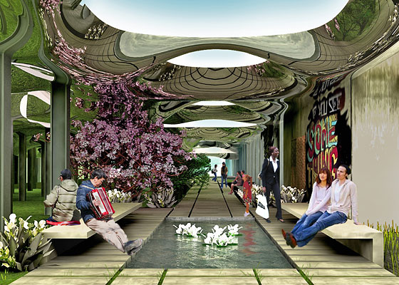

“Technology enables us to create an appealing green space in an underserved neighborhood,” says Ramsey. The key, he says, is the “remote skylight,” a system that channels sunlight along fiber-optic cables, filtering out harmful ultraviolet and infrared light but keeping the wavelengths used in photosynthesis. “We’re channeling sunlight the way they did in ancient Egyptian tombs, but in a supermodern way.” Ramsey envisions a stand of dozens of lamppostlike solar collectors on the Delancey Street median, feeding a system of fixtures down below.

The MTA controls the terminal, where trolleys plying the Williamsburg Bridge looped back toward Brooklyn; Ramsey says the agency has been willing to listen to his pitch, though it won’t contribute any funds. The next task is to sell the neighborhood on a park with walls and a ceiling supported by I beams.
While initially only envisioned as a public park by its creators, the space could be used for other purposes, considering it sits next to the undeveloped lots in the Seward Park Urban Renewal Area (SPURA). Questions about maintenance and security of the site gave way to discussions about how it could best serve the surrounding area, with the eventual development of SPURA set to bring in hundreds of new residents. For instance, the space could instead be used for underground parking for the neighborhood, offered committee member Damaris Reyes, who wanted to make sure it “won’t just become another tourist attraction.” Others wondered how such a lofty, technologically advanced project would be funded.
Numerous questions still need to be answered regarding the cost and feasibility of the project, the committee noted however that no funds from the subsidies set aside for SPURA would be used for it.
The High Line
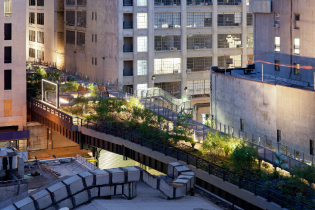
The High Line is located on Manhattan’s West Side on a 1.45-mile section of the former elevated freight railroad spur called the West Side Line, redesigned and planted as an aerial greenway. It runs from Gansevoort Street in the Meatpacking District to West 34th Street, between 10th & 11th Avenues. Section 1 of the High Line, which opened to the public on June 9, 2009, runs through from Gansevoort Street to West 20th Street. Section 2, through the neighborhood of Chelsea between West 20th and West 30th Streets, opened June 8, 2011.
In 1999, neighborhood residents Robert Hammond and Joshua David created the community group Friends of the High Line to push the idea of turning the High Line into an elevated park or greenway, similar to the Promenade Plantée (2.9 mile tree-lined walkway built on the old Vincennes Railway) in Paris. The project later obtained financing and backing from prominent figures. The park was designed by the James Corner’s New York-based landscape architecture firm Field Operations and architects Diller Scofidio + Renfro, with planting design from Piet Oudolf of the Netherlands and engineering design by Buro Happold.


The High Line in Manhattan (2010), New York City at West 20th Street, looking uptown (north) at the unreconstructed portion. Photo By Beyond My Ken
The recycling of the railway into an urban park has spurred real estate development in the neighborhoods that lie along the line. The High Line has helped usher in something of a renaissance in the neighborhood: by 2009, more than 30 projects were planned or under construction nearby. It has also fostered a stronger sense of community for area residents, giving them a place to walk through, a landscaped parkway leading neighborhoods, nightlife,work and school. It provides a compelling example of urban reinvention for cities across the world.






Pingback: Ecological Urbanism: A City Green Re-imagination – By Jack Eidt | WilderUtopia.com