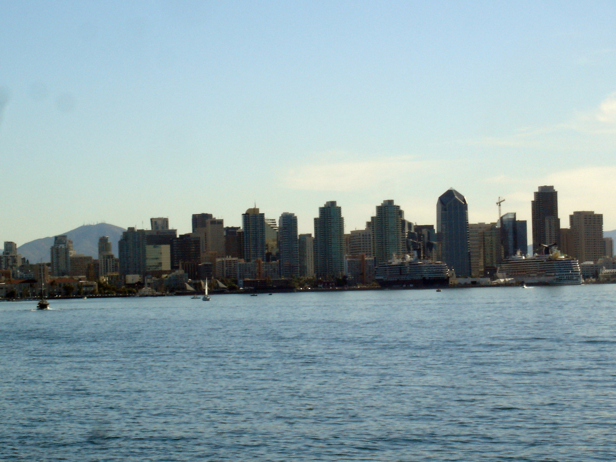

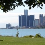
San Diego, a militarized metropolis with a deeply stratified economy, began as a series of villages amid canyons served by public transit, transformed into freeway-close suburban sprawl, but slowly reimagines the sustainable village model.
Militaristic Metropolis on an Earth-Based Rebound
Neighborhood destination walkability. Affordable and varied housing choices with shops and offices nearby, accessible through public transit and bicycle lanes. A landscape dominated by preserved parks, farmland, and wilderness habitat. We all want to live there.
Across the US and beyond, facing increasing energy costs and constrained public investment in infrastructure, we find ourselves confined to sprawling overpopulated suburbs designed around the automobile. Nowhere to walk, ignoring our neighbors, and socializing through television and the internet. In San Diego, many saw a city of missed opportunity, expansive and poorly regulated sprawling development, but hope for a City of Villages, a visionary city plan approved in 2007 but in varying states of implementation. Here begins our story, narrated in discussions, panels, and neighborhood tours at the New Partners for Smart Growth conference put on by the Local Government Commission in the first days of February 2012.
Real Estate Robber Barons, Municipal Corruption, and “America’s Finest City”
San Diego, the seventh largest US city, blessed with endless sunshine and breezy beaches, harbors a dark side exposed in Mike Davis’s Under the Perfect Sun: The San Diego Tourists Never See. The historical sketch deconstructs this militarized metropolis with a deeply stratified economy, politically dominated by anti-union conservatives. Endemic municipal corruption featured the late 19th Century son of a sugar magnate turned robber baron John D. Spreckels, who monopolized land development, bought up water sources, acquired media outlets to control his supremacy, and pushed forward transportation to his holdings. He did however develop the San Diego street car system that helped create village-like neighborhoods near downtown flanking the park. Another land developer and “Colonel” Ed Fletcher also advocated for massive San Diego County water systems and highway development at the turn of the 20th Century, laying the ground for the boom of suburban sprawl and military bases that define the landscape today.
Later San Diego suffered through the elaborate 1950-70s ponzi schemes of businessman-banker-Nixon-amigo-Padres-owner C. Arnholt Smith, an investment and local government “rainmaker” during the expansion of regional freeway sprawl serving the tourism-based economy. After tax-free self-appropriating assets from his publicly-owned bank to his publicly-owned corporation, his bank to failed and he did time tending roses at a county honor farm. Then Mayor Pete Wilson seemed like a reformer in the ’70s and ’80s but gave away public land to elite associates and converted rental apartments en masse to condos. He later dubbed San Diego “America’s Finest City.”
Modern day pension fund and bribery scandals prohibited city government from making significant changes to the unsustainable mix, but hope for a sunnier tomorrow always punctuates San Diego’s worldview.
Capitalist Dreams and Development Infrastructure Reshape Wild San Diego
Balboa Park. Land use decision making through history repeatedly undermined the city’s natural richness and neighborhood livability for the demands of domineering real estate robber barons and the unsustainable sprawl they left behind. A Spanish land grant set aside the future Balboa Park, with museums and performance pavilions sprouting for the Panama-California Exposition of 1915-16. A most fortuitous undertaking, this established the small city as a natural gem with pretensions to New York’s Central Park. The Expo itself meant to publicize San Diego as an important US port in relation to the inter-oceanic canal planned for Panama and Spreckels to his credit championed the effort. Unfortunately, city fathers bisected Balboa Park in 1948 with California State Route 163 and cut off another portion by building Interstate 5 in the 1950s, paving over 111 acres. This consigned the park to deafening commuter noise and blocked human and wildlife mobility, so much for their Central Park model.
Mission Valley. The San Diego River Valley or La Cañada de San Diego was inhabited by the Kumeyaay People for 10,000 years. The western edge became the original Spanish settlement of the Presidio and Mission of San Diego de Alcalá, both established in 1769 where Old Town is today. The valley remained as dairy farms until the 1940s when the push to control flooding and pave it through questionable back-room deals overwhelmed calls for preservation and protection. With vast wilderness habitat, water resources, agriculture, and open space potential, developing Mission Valley with hotels, malls and Interstate 8 has proven a regional environmental tragedy. By bulldozing the Valley’s fertile marshes, fields, and biodiverse delta estuaries, by upstream damming and draining urban oily and trash-filled stormwater into the river, by re-routing the flow to the dredged and paved resort development that is Mission Bay, ocean contamination, beach sand replenishment, and water sustainability have been irrevocably altered.
San Diego Canyonlands. As well, San Diego is known for a number of open space canyons, with a total of 3,200 acres preserved in the city. Switzer Canyon, Tecolote, 32nd Street, and Mission Trails are just a few that stretch from downtown all the way into the eastern foothills. While the existence of these snapshots of wilderness amid neighborhood villages provides urban relief and minor wilderness habitat, had a comprehensive plan been developed to connect these various area, endangered and threatened plant and animal species biodiversity could have been protected. An excellent documentary covers this issue from the San Diego Canyonlands Restoration and Enhancement Planning effort.
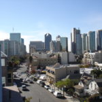
 Downtown Resurgence: A Smart Growth First Step
 Downtown Resurgence: A Smart Growth First Step
Downtown San Diego during the 1960s became neglected and blighted to a metropolis of single-family homes and passenger automobiles spreading into the horizon. The Centre City Development Corporation set out to revitalize the downtown landscape and economy and its 16 1/2 block Gaslamp Quarter, beginning with construction of the Populist Post-Modernist downtown mall called Horton Plaza. Uprooting a modest park and demolishing several historic structures, named for a mid-18th Century downtown land speculator, with massive financing and design snafus, the project finally came to redefine the Quarter as a place to work, shop, convention, and ultimately live (for those who could afford it). The downside has been an escalation in land value and cost of living with significant dislocation for low-income populations who had settled in the once-forgotten district.
In a later piece, we will investigate how San Diego has confronted these challenges with the City of Villages Plan, C3’s Sustainable Paradise Plan for the San Diego-Tijuana Region, and SANDAGs Sustainable Communities Strategy to comply with Senate Bill 375 and the 2050 Regional Transportation Plan. Follow this link for a review of San Diego’s first in the state SCS.
Updated 5 August 2023


Pingback: Smart Growth: San Diego's Approach to Sustainable Communities | WilderUtopia.com
Pingback: Tribute to the Late Urban History Provocateur Mike Davis - WilderUtopia